| |
History - Town of Barrington
From the History of Yates County, NY
published 1892, by L.C. Aldrich
pg 454 - 456
History of Barrington
Among the towns of Yates County, Barrington occupies a position on the south. As a part of the Phelps and Gorham Purchase, the survey into townships brought Barrington as number six
in the first range; from which it may be inferred that the eastern boundary of the town was the pre-emption line, and that between its south boundary and the Pennsylvania north line
were five other townships, each being approximately six miles in north and south measurement. The original survey of Barrington, under the Phelps and Gorham ownership, brought three
of its lots, No. 73, 74 and 75, to the westward of Lake Keuka; and these were annexed for convenience to Jerusalem. Therefore the township of Barrington exclusive of the part of the
lake within its survey and the three lots west of the lake, include considerably less than thirty-six square miles.
The town of Barrington was one of the parcels conveyed by Phelps and Gorham to the New York Genesee Land Company, or to its representatives, in comp omission of the pretended claim
of the company to right of possession under the long lease made with the Six Nations; and like most of the other towns, Barrington was lotted and drafted by and among the persons interested
in the company. The lot drawn by each represented an interest in the company of a shareholder. This process was maintained by the company through all, or nearly all, of the towns deeded
to it by Phelps and Gorham. But it appears that a portion of the Pultney estate, represented by Agent Charles WILLIAMSON, while still another part passed to the Hornby estates, and
that but few of the lots originally drawn for by shareholders in the lessee company were sold by them directly to settlers within the town, but the titles in some way passed to the
Pultney and Hornby estate, and the lands were subsequently acquired by actual settlers from the agents of the estates or associations.
Barrington was not an original town of Yates County. On the 18th of March, 1796, Steuben County was erected, and included within its boundaries all that is now called Barrington, and
Starkey as well. Upon the organization of Steuben, and the formation of its territory into townships, all that is now Barrington, together with what is now called Starkey and Tyrone,
Wayne and Reading, comprised the original town of Frederickton, so named after Frederick BARTELS, or BARTLES, a Dutchman employed by Charles WILLIAMSON, and who built a mill on the
outlet of Mud Lake, in 1793. The town of Reading was afterward set off, and Wayne organized, including Barrington. In 1822 Barrington was organized, its first town meeting being held
in 1823 on the 24th of February, when officers were for the first time elected.
Still the town remained a part of Steuben County until January 1, 1826. On the 5th of April, 1824, the Legislature passed an act, providing “that from and after January 1, 1826, all
that part of Steuben County including Barrington, “ etc., shall be annexed to Yates County.
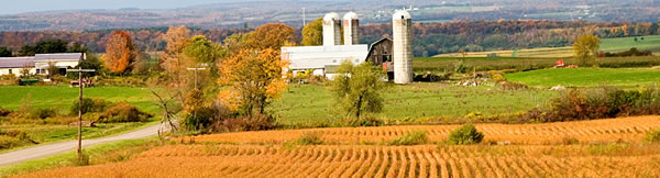
The town of Barrington has its entire western boundary on Lake Keuka, a most desirable possession, for here is the very garden of the grape and fruit growing industry. Once an agricultural
town of some prominence in the county, but now its tillable lands are turned into vineyards, and its meadows into orchards. In agriculture the town was rich, but in fruit growing it
is still more productive. In this respect the town is second to none in the county. Still the town has its farmers, and thrifty, progressive and forehanded they are, too.
The surface of the land in the town is peculiarly adapted to the use to which it is put. Lying on the east side of the lake, the hillsides fine ample protection from the severe western
winds in the moderating influences of the lake waters. The ascent back from the shore is nearly a mile long, sometimes greater than that, while the elevation attained varies according
to locality from 300 to 800 feet. The greatest altitude attained is at Barrington Summit, where the elevation is 880 feet above the water of the lake. Crystal Springs, a resort of great
fame, is 315 feet higher than the lake.
The center of population and improvement in what we may call Yates County proper, during the first fifteen or twenty years of its history, was in the vicinity of Seneca Lake, the place
pitched upon by the Friends. Here was the center point of settlement in this region, and from thence it spread throughout the surrounding country, following the courses and occupying
the lands, which the pioneers considered best for personal interests. But Barrington appears not to have been touched or settled to any extent until the closing years of the first decade
of this century. In fact, the pioneers of the region, in searching out the most desirable lands for their homes, appear to have given not thought of the elevated lands of this town
as valuable to agriculture, but they turned toward Jerusalem, and Milo, Benton, northern Torrey, Starkey, and even Potter to a limited extent, as preferable to the ridge and gullies
and dense woodlands of Barrington. True it is that the lands of Barrington offered no special inducements, no inviting future prospects to the pioneer, but he who believes that the
lands were poor or unproductive was an error, for there were and are as highly productive farms in this town as can be found in the county.
Pg 448 – 450
The civil and social history of Barrington has been made in every day live of its people; in the establishment of its churches and schools, and in the passing away of those who have
finished their course. The present generation of dwellers in the town is engaged in the pursuits of agriculture and fruit growing, to which occupations reference is made on succeeding
pages. The town has its hamlets and settlements, but none of these has population to warrant incorporation or the adoption of any form of municipal government.
The first town meeting of the freemen of Barrington was held in 1823 on the 24th of February, at the house of pioneer Daniel RAPALEE; at which time offices were elected as follows:
Supervisor, Richard EDDY; town clerk, Daniel RAPALEE; collector, Joseph MC CAIN; commissioners of highways, James A. SWARTHOUT, Jeremiah SHAW and Lodowick DIISBORW; commissioners of
schools, Ephraim BENNETT, Matthew MC DOWELL and Robert ARMSTONG; assessors, Tippett SUNDERLIN, Ira CHURCH, and Matthew KNAPP; overseers of the poor, Victor PUTNAM and Ezekiel BLUE;
constables, Elijah BAKER, Joseph MC CAIN and Peter PUTNAM Jr.; inspectors of schools, Dennis SUNDERLIN, Ira SUNDERLIN, Richard EDDY; poundmaster, Daniel RAPALEE.
It seems to be conceded that the chief officer in each town is the supervisor; and it has become an established custom to furnish a succession of the incumbents of this office from
the organization of the town to the date of compilation. Conforming to this rule, the appended record gives the succession of supervisors of the town of Barrington, as follows: Richard
EDDY, 1823; Alexander PATTEN, 1824-27; Ephraim BENNETT, 1828; Asher SPICER, 1829; James A. SWARTHOUT, 1830-31; Stephen ROBINSON, 1832-33; Ezekiel BLUE, 1834-35; John SPICER, 1836-37;
Levi KNOX, 1838-39; Lodowick DISBROW, 1840-42; George W. WOLCOTT, 1843-44; Martin HOLMES, 1845; John WRIGHT, 1846-47; Archibald CAMPBELL, 1848-49; Chauncey BOYCE, 1850; Daniel DISBROW,
1851-52; William KINNE, 1853; Martin HOLMES, 1854; Samuel V. MILLER, 1855; Daniel DISBROW, 1856; Joseph F. CROSBY, 1857; Samuel WILLIAMS, 1858; George N. WILSON, 1859; Abel WARD, 1860;
Peter H. CROSBY, 1861; Jonathan TAYLOR, 1862; Asa P. FISH, 1863-64; Delazon J. SUNDERLIN, 1865-66; Benson SMITH, 1867; Jesse C. KNAPP, 1868; Sackett B. WIXSON, 1869; William MC DOWELL,
1870; George HELS, 1871; Isaac CROSBY, 1872; William S. ELLIS, 1873; Benjamin F. FREEMAN, 1874; Robert ROBSON, 1875-76; Asa P. FISH, 1877; Isaac Crosby, 1878; George HELS, 1879; Gilbert
HOPKINS, 1880; Julius STANTON, 1881; Cyrus A. LAWRENCE, 1882; Henry BULLOCK, 1883; William WINTERS, 1884-86; Albert OVENSHIRE, 1887-88; Cyrus A. LAWRENCE, 1889; Jesse C. KNAPP, 1890;
John A. GIBBS, 1891.
History & Directory of Yates County, Volume I
by Stafford C. Cleveland
published 1873
Chapter VI - Barrington pg 139 - 142
The town of Barrington is formed of so much of township number six, in the first range of Phelps and Gorham’s purchase, as lies east of Keuka Lake. Lots 73, 74, and 75 of the original
survey of that township are west of the lake, and included in the town of Jerusalem. This township was one of those ceded by Phelps and Gorham to the New York Genesee Company, otherwise
knows as the Lessee Company, in the final settlement of their claims; and like townships seven and eight was “draughted,” as it was called, after being surveyed into lots, and drawn
by lot, by those holding stock in the Lessee Company. The map of what purports to be the original survey of the township by B. ALLEN, in the writer’s possession, gives the names of
those by whom the lots were drawn. James PARKER drew lot 64; William POTTER drew lot 27 and Benjamin BIRDSALL drew lots 17 and 52. B. ALLEN, the surveyor, drew lots 23 and 36. H. TREMPER,
lots 53 and 46; L. TREMBER, lot 13; A. LATTING lot 34. As these lots are all designated on the latest county map (that of 1865,) they can be easily traced. Some of the land was afterward
bought by Charles WILLAIMSON, and passed to the PULTNEY estate. Some fell in some way to the HORNBY estate, and little if any of it was bought by the settlers directly form those who
drew the several lots on behalf of the Lessee Company. The origin of the strip or parallelogram, called the Gore, on the south line of Barrington, is not explained by the map of B.
ALLEN’S survey, and how it occurred has not been elucidated by any researches that have been made in the preparation of this work. It has been conjectured that it arose from the survey
of lots from north to south, by which a remnant was left on the south side. If this is the true explanation, it occurred from a re-survey, made AFTER that of B. ALLEN, as nothing of
the kind was noted on his map.
The land was heavily timbered in the east and south part with a dense growth of pine, and on the western slope more with oak and other hardwood. The ascent from Keuka Lake to the ridge
in the middle of town is quite steep, and is said to be not less than 400 feet higher than Bluff Point, though no actual measurement of either elevation is recorded. The descent eastward
to the Big Stream Valley, is even more steep, for a considerable distance and these abrupt elevations and depressions, extending to what is called “East Hill”, in the southeast corner
of the town, invest it with a decidedly rugged appearance, which no doubt aided to give it an unfavorable repute with the early settlers of the country.
For nearly 20 years after the first settlement by the Friends on the west bank of Seneca Lake, the now fruitful and populous town of Barrington was a dense and uninviting wilderness,
and the valley of that branch of Big Stream, known as Chubb Hollow, was the favorite refuge for wolves for nearly 30 years after the occupation of civilized men hand begun to make inroads
upon the forest. It was an upland which looked to the early settlers like a hard and unpromising tract of country, and the wolf and deer were left in undisturbed possession until what
were thought the better lands of Milo and Benton had become pretty well occupied. In 1800, Jacob TEEPLES called Col. TEEPLES, erected the first habitation on the spot where about 1804,
he commenced keeping a public house, which continued to be kept as a tavern by himself and afterwards by Daniel RAPLEE, Levi KNOC and others for many years, and until the village, since
known as Warsaw, became the center of affairs in that town. It would seem that Jacob TEEPLES for several years occupied a very isolated position. He was on Capt. WILLIAMSON’S road,
leading from Geneva to Bath and that became an important highway in later years, but before 1810 it was not a rout largely traveled. But Jacob TEEPLES could not have been an unsocial
man, for he provided cheer for his fellow men when they began to pass his door in sufficient numbers to make it an object. And a few years later, he was sent to the Legislature as a
member of the Assembly from Steuben county. He served two terms in 1812-1813; and was also Sheriff of Steuben county from 1808 to 1810. He sold his place finally, to Daniel RAPLEE,
and removed from that town. He was evidently a man of considerable prominence, but is remembered now by few of the living. After abiding alone in that township half a dozen years, there
came in 1806 a number of neighbors; people were neighbors then for a dozen miles around. That year, William OVENSHIRE bought and located on the place now owned by Erasmus WRIGHT. Thomas
BRONSON too up his residence on the place afterwards owned by John SPICER. Oliver PARKER, the only son of James PARKER, on lot 27. William COOLBAUGH near the same valley, on land now
owned by John MILLER. Joseph FINTON came the same year and located where Joseph S. FINTON, his son, now resides. James FINLEY also located in 1806 on the Bath road, on the town line
of Barrington and Milo. James and Nehemiah HIGBY, brothers, and son in laws of Joseph FINTON, settled the same year adjoining Joseph FINTON, and the same years John CARR located near
the lake, on the place where Job L. BABCOCK lived about 30 years. John CARR built the first and only grist mill in that town, till the past years, when one has been started by Clinton
RAPLEE on Big Stream, near the east line of the town. CARR’S mill was a moderate affair, and was long since discontinued. Mathew KNAPP soon settled near the old TEEPLE’S tavern, and
Peter RETAN and Janna OSGOOD in the same neighborhood. A man by the name of GRANGER, was the first settler on the farm now owned by Erasmus WRIGHT. GRANGER raised his house on the day
of the total eclipse of 1806. Eclipses were probably not as well advertised then ad now, for the people at the house-raising were much frightened, till a young man who had read of it
in a newspaper, told them what was causing the untimely darkness, where their fears were allayed.
It was a region of very abundant game. William OVENSHIRE states that he had seen 15 deer in a single drove, and has known them to come familiarly among his cattle to browse on trees
cut down for them to feed upon the tender twigs in the absence of hay. Every Fall, for several years, the Indians came and occupied their wigwams along Big Stream, and hunted through
most of the winter. In 1807 a snow fell four feet deep in the month of April; and an immediate thaw, followed by a hard freeze, left such a crust on the surface of the snow that the
wolves could run on it while the deer broke through. The consequence was a terrific slaughter of the poor helpless deer by the ravenous wolves. A wolf would seize a deer, insert his
nose in the jugular vein, suck up its blood and pass on in pursuit of another. The bodies of slain deer were thick in every direction.
The west side of the town was thickly infested with rattlesnakes. Joseph S. FINTON relates that his brother and brother in law, killed nine of these serpents in one half day. But badly
as these creatures were feared, they did but little actual harm, and were far less dangerous than the whiskey bottles that were cherished so warmly by many of the early settlers. They
had other foes to contend with more difficult to drive away than the snakes. Money was hard to get, and ashes were sometimes the best commodity they could sell. Peter H. CROSBY states
that he sometimes cut down trees in the woods, and burned them for no other purpose but to get the ashes to sell to raise a little money. It is not strange that people who stood their
ground against these hardships, have held a goodly inheritance in the land since, and made it smile with plenty.
HTML by Dianne Thomas
Copyright 2004 - 2008
|
|
|
 |
|
